It stands at the top of Cape Billao, or Villano, on the coast of the municipality of Gorliz, from where the cliffs and the vastness of the sea can be viewed.
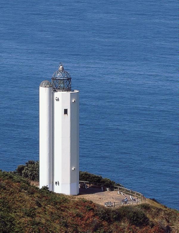
It was built in 1990 and is one of the icons of Gorliz. Its light has helped prevent many ships from running aground at night or due to adverse weather conditions.
It is the highest lighthouse in the Basque Country. It is located 165 metres above sea level. The body consists of two white concrete towers, one cylindrical and the other octagonal, 21 metres high, which are attached to each other. The white colour is reminiscent of the traditional buildings of coastal Basque villages. The tower is crowned by a glass lantern with metal rods, giving it an avant-garde and non-traditional look.
Lighthouses are generally named after the head on which they are geographically located. In this particular case, it turned out that there was already another Villano Head, in Galicia, which gives its name to the lighthouse built there. That is the reason why there could not be another lighthouse of the same name and that is why this one bears the name of the town in which it is located, Gorliz.
This has benefited Gorliz as it has placed the name of the municipality on the map of lighthouses.
In 2007, the Spanish Post Office published a special edition with a print run of stamps featuring the Gorliz Lighthouse.
The lighthouse is located on a promontory with 180 degrees sea views.
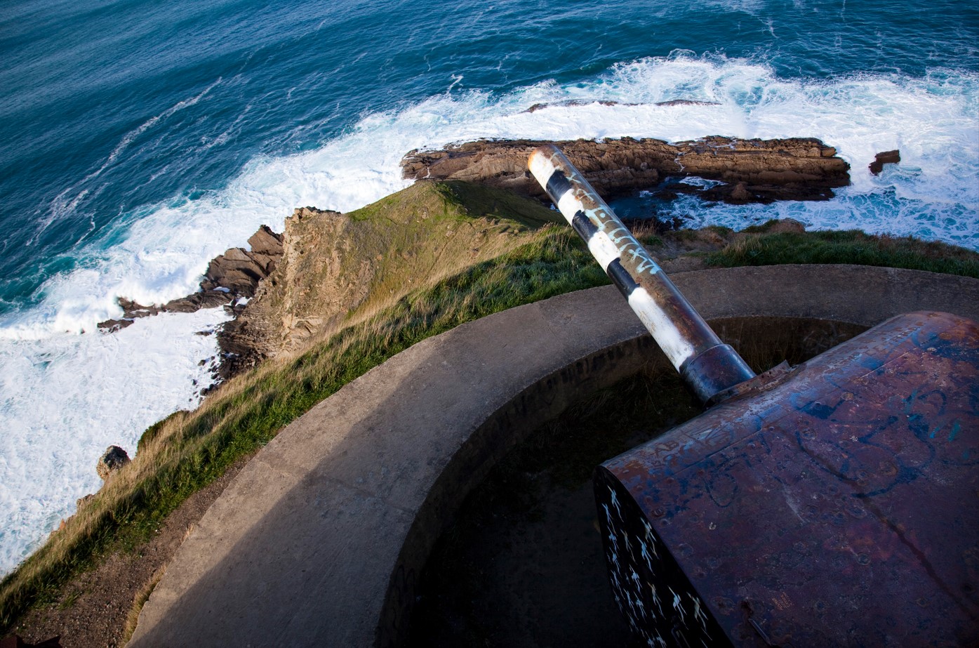
In the 1940s, Franco's regime built bunkers and firing positions on a coastal defence line, fearing a possible Allied attack, which never took place. Of this coastal battery, the galleries and a cannon are preserved very close to the lighthouse.