
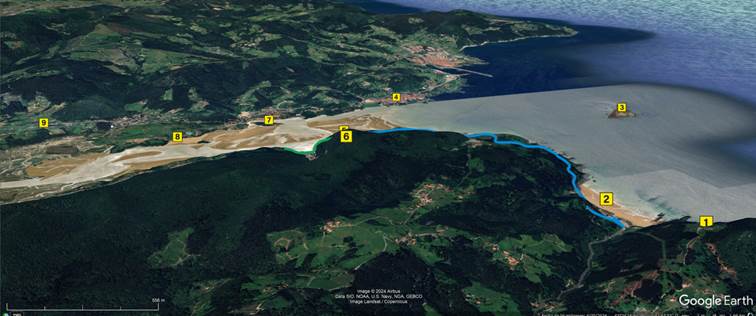
This route, around the beaches of Laida and Laga, both in the municipality of Ibarrangelu, is a window onto the spectacular landscape of Urdaibai. From it, we can see and identify the eight most notable points at the mouth of the estuary .
In addition, two more distant points are indicated, since they are of great interest for getting to know the area and whose visit is easily accessible for people with reduced mobility.
The map shows: the route , the 10 points of interest and other complementary information .
The route has been divided into sections based on accessibility and is shown on the map in different colors.
If you arrive by private vehicle, it is recommended to start the route in Laida, as it is the most convenient place to park and the starting point for both sections.
If you arrive by bus , you can choose from 5 stops . Before deciding, we recommend reading the information in the "Proposed routes, accessibility description" section .
The points seen from the route, and about which information is provided, are of general interest and are not necessarily easily accessible for people with reduced mobility. Urdaibai is a rugged area; if you wish to visit any of these places and have a disability, it is advisable to consult with the tourist office in advance .