Easily accessible route for people with reduced mobility, a flat 2.92-kilometer walk with minimal slopes.
The route runs almost entirely parallel to the estuary, protected by a railing or railings.
Starting in the inner part, we walk towards the sea, leaving the estuary on the right. After reaching the lighthouse and returning 600 meters, we turn right to visit the park.
DETAILED DESCRIPTION OF THE ROUTE:
In this route we have to distinguish 4 sections:
- From point 1 (museum) to 3 (music kiosk, in Plaza de El Solar):
We leave the museum, which is located on the banks of the estuary on our right. We can walk along the pier or along the parallel promenade that forms the park.
If you decide to walk through the park, the Renfe Cercanías train station is located almost opposite the museum, and in the middle of it, there is a large covered playground, very practical on rainy days.

250 meters from the playground we find point 2 , the building known as "La Canilla", where the Tourist Office is currently located.
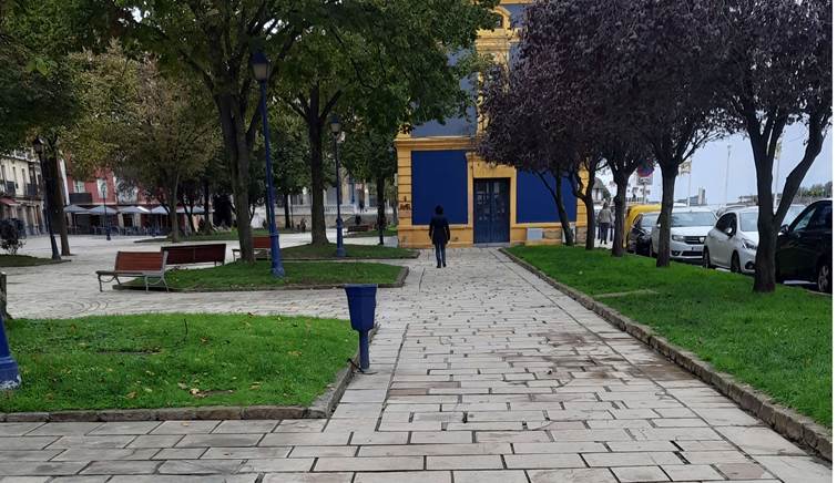
Later, continuing through the park, on the left side, we find numerous pleasant terraces where we can have a drink.
The park ends with a staircase that can be reached via a ramp on the right, which leads to the square.
If you choose to walk along the pier, it is interrupted (at the point where the park ends and the square begins) by a small jetty where the pilots are based and where boats board to cross to the other side of the estuary. At this point, there are some steps to the left that lead to the continuation of the walk.
Be careful! About 25 meters ahead, there's a nice photocall in the middle of the promenade with the Portugalete lettering. It's located in the center and takes up a large portion of the promenade, but it's easy to walk around the sides.
If you need a ramp, it's located about 30 meters ahead, on the left, just before the photocall. It's easy to see because you can see the handrail and the gradient. We return to the promenade along a stretch of sidewalk.

The dock floor is made of large, smooth tiles. In the park, two distinct areas must be distinguished: the central one is made of cobblestones, and the lateral one is made of large tiles.
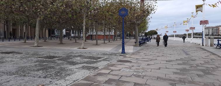
In the Plaza de El Solar the floor is made of large tiles.
There are BENCHES both on the pier and in the park.
- From point 3 (the end of Plaza del Solar, where the kiosk is) to point 5 (tidal gauge), we continue parallel to the estuary that is to our side. Right. This part of the promenade has small trees, benches, streetlights, and trash cans along its center line.
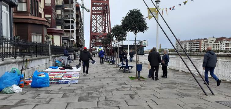
In this section, after walking about 100 meters, we will find Point 4 corresponding to the Bizkaia Bridge.
Occasionally, the stretch of the promenade near the buildings, as we turn left, is occupied by street vendors. People with low vision should pay attention to the bridge's tension cables, which are located along the promenade, between the benches and the river, about 50 meters before and after the bridge towers.
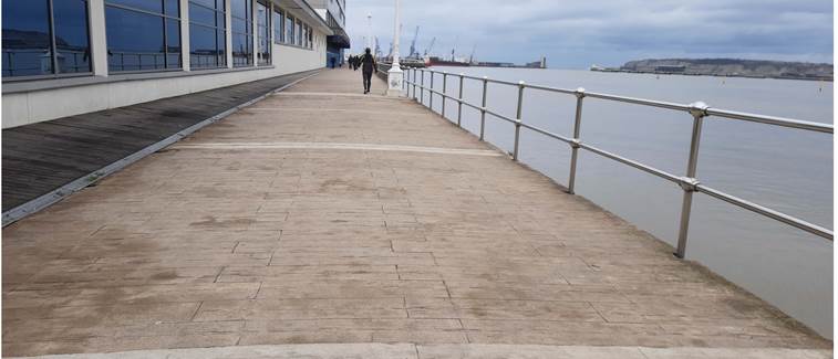
- From point 5 (tidal gauge) to point 6 (iron pier that ends at the lighthouse) you first go through the so-called Muelle Nuevo and then the Muelle de Hierro.
At the New Pier, which corresponds to the section with a building on our left where the Nautical Club is located, the ground is smooth. There is a railing on the right side that requires caution with children, and on the left side, a small drainage channel about a meter and a half from the building. There are no benches.
At the beginning of the Iron Pier, the ground is similar. Now the sea is on both sides, where there are railings like the ones on the previous section, so caution is necessary with children.
There are BENCHES to rest on.
The last few meters before reaching the lighthouse are made of old cobblestones, and to reach the lighthouse, you have to climb some narrow stairs. If you have no mobility problems, it's recommended to take them and enjoy the views.


- From point 5 (tidal gauge) to 7 (Doctor Areilza Park) the route runs along sidewalks with lowered edges and pedestrian crossings with tactile pavement.

Explanatory panels
Along the tour, there are three interesting explanatory panels accessible to people with vision impairments, with tactile-visual images. These panels are difficult for wheelchair users to access, as they are high and very deep, and the first one has a step to access.
Additional panels have recently been installed that are wheelchair-accessible and are distributed throughout the most popular areas of the municipality.
The tactile-visual panels are located near the estuary:
Between point 2 (La Canilla station) and point 3 (the kiosk), on the small landing stage where boats crossing the estuary board. It's located on a sidewalk that doesn't have a lowered curb.
· About 50 meters before reaching point 4 (the Bizkaia Bridge), with explanations and images related to it.
· About 70 meters after crossing the bridge, with explanations about El Abra and its historical importance.