1. Fuente del Suso Fountain Philip II’s Relaciones Topográficas (Topographic Relations) from 1576 places this fountain in the outskirts of the town. As early as 1782 it was documented that the fountain was located inside the town, giving the Barrio de Arriba its name. It has been remodelled several times, the most important being after 1804 when it was buried by a landslide.
2. Fuente del Chorrillo Fountain The fountain cited in 1576 as Fuente del Pilar was outside the town centre. In 1919, with the aim of getting the most of its waters, its location was moved to inside the town.
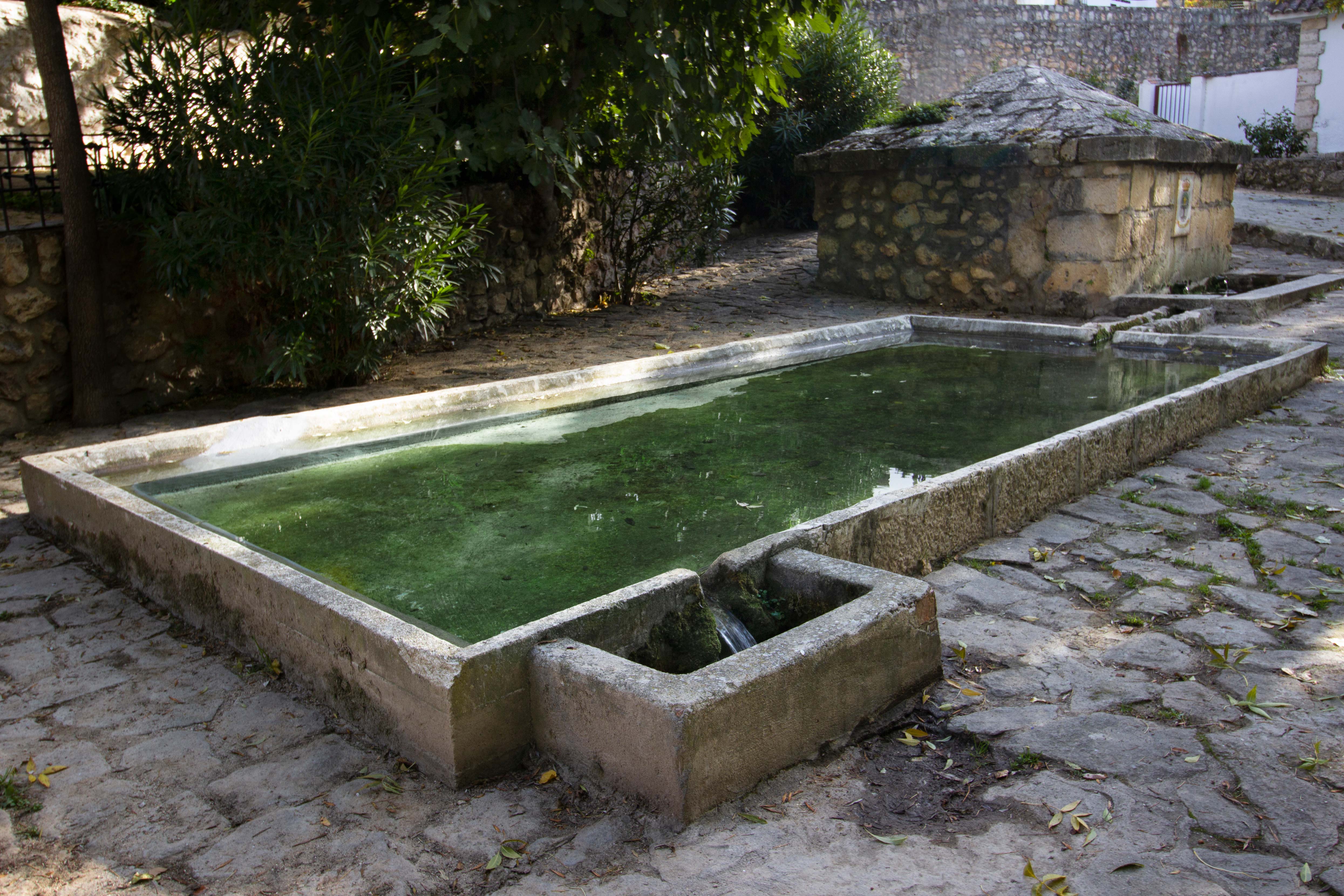
3. Fuente de la Aldea Fountain In 1576, it was likely the town’s main fountain. In Philip II’s Relaciones Topográficas, it reads: ‘[...] there is a fountain in the same town with excellent water that is said to be the town’s source. [...]”. This fountain, like the other two, was remodelled most recently in 1993.
4. Fuente el Cura Fountain A recent fountain located where there was originally a natural spring. Made from granite decorated with scattered clay tiles. The name is formed of brown tiles to match the other tones. It is framed with brick and clay slabs.
Legend of the Cruel Lady of Valmores
In 1827, Sebastián Miñano referred to this place in the section dedicated to La Olmeda de la Cebolla in his Geographical Dictionary, mentioning the ruins of an ancient temple: The settlement was said to have been cursed after a murder was committed inside the church, leading its inhabitants to relocate to their current site. This event is recorded in the Topographical Reports of Philip II (1576), as follows (translated):
“...Valmores, in which there is a hermitage called San Blas de Valmores, as has been said, according to what can be ascertained. The reason why it was depopulated is said to be that, while living there, a noblewoman quarreled with a field guard and ordered one of her slaves to strike him with a knife. The slave pursued the guard, who took refuge in the church of that village, called Our Lady of Valmores, whose building still stands today. The guard threw himself before an image of Our Lady, but the slave struck him with a knife and killed him. It is said that this was the reason why the village was abandoned...”
Valmores Walking Route
On the banks of the Vega stream, some 400 metres from the road that joins Olmeda de las Fuentes and Nuevo Baztán, the ruins of the church, together with the remains of a mill and those of the Hermitage of St. Blas, hold the truth of the legend of the uninhabited village of Valmores, which, according to popular belief, would be the seed of Olmeda de las Fuentes
The origin of a name
The name of the locality ‘Olmeda’ first appeared in a document from 1188 as ‘El Alameda’. During the period from 1188 to 1214, this toponym changed from ‘El Alameda’ to ‘El Olmeda’ due to the political and territorial context of being given over to Segovia and the Archdiocese of Toledo. In 1564, the feminine article ‘la’ in Spanish began to be used, and by 1576, the name evolved to ‘Olmeda de la Cebolla’, reflecting local characteristics such as the abundance of elms and onions. This name was kept until 1954, when steps were taken to change it to ‘Olmeda de las Fuentes’, proposed by the mayor at the time to reflect the wealth of natural springs in the area. The change was made in 1954, highlighting the community’s desire to adopt a more representative, euphonic name for the town.